25 km around Boston

Lighthouses, forts and beaches near Boston

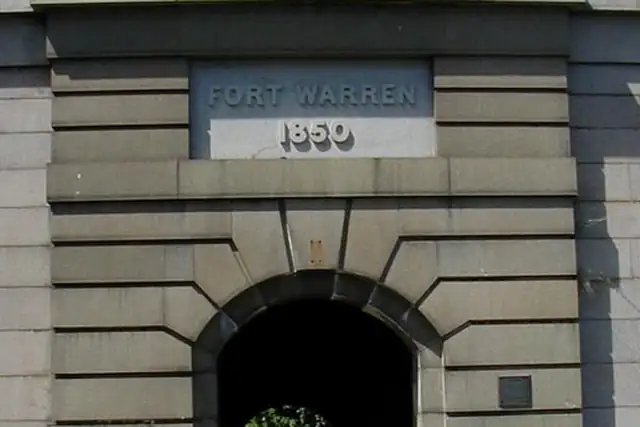
Boston Harbor does the work here: Fort Warren on Georges Island at 11.6 km, Fort Strong and its batteries at 9.1 km, Long Island Head Light (1901) at 9 km, Deer Island Light, The Graves Light at 15.7 km. Sixty-seven beaches follow, Pleasure Bay Beach at 4.2 km first. Up the coast, Derby Wharf Light and Fort Pickering Light (1871) in Salem sit right at the edge of the circle.

The 234 peaks are the odd number. Boston is not mountainous; these are the city's named hills, Beacon Hill 0.5 km from the center, Copps Hill, Breeds Hill at 2 km, Meeting House Hill. The Custom House Tower Observation Deck at 0.5 km and Eliot Tower (1934) at 16.7 km are the viewpoints worth the climb. An island fort takes a ferry to reach, and RLQuest still checks that you got there.

67 Beaches and swimming spots52 Monuments24 Ruins23 Viewpoints10 Forts7 Archaeological sites6 Lookout towers5 Lighthouses

Where the places are

Each hexagon covers a little over 5 square kilometers. The brighter it glows, the more places are inside it. The numbers mark the highlights listed below; the dot in the middle is the center of Boston.

Few places to many

12345

Worth the trip around Boston

The places with the most to tell about. The numbers match the map.

Places by type

A selection for each type, best known first. The number next to each heading counts everything RLQuest knows within the radius.

Castles and palaces 1

  • Usen Castle16 km

Lighthouses 5

  • Deer Island Light8.9 km
  • Derby Wharf Light23 km

Viewpoints 23

  • North End Parks0.5 km
  • Custom House Tower Observation Deck0.5 km
  • Foster's Pavilion0.9 km
  • Harborwalk Lookout1.4 km
  • Skywalk Observatory2.2 km
  • View of Boston from BU Bridge4.2 km
  • CCC Overlook #27.7 km
  • CCC Overlook #17.7 km
  • Ziggy's Rock9.0 km
  • Ocean View9.2 km
  • Plympton Mill Remains12 km
  • Echo Bridge15 km

and 10 more

Waterfalls 2

  • Cascade Falls9.8 km
  • Rock Falls18 km

Ruins 24

  • Historic Springhouse8.8 km
  • Site of Fitchburg Railroad Hill Crossing Depot9.1 km
  • Brooks Estate Carriage House11 km
  • Lighthouse Depot Wharf11 km
  • Ebenezer Fiske House Site19 km
  • Ruined stone house20 km
  • Thomas Nelson Jr. House Site20 km
  • Josiah Nelson House Site20 km
  • Colonial Second Church of Christ Ruins22 km

and 15 more

Forts 10

  • Battery Stevens9.0 km
  • Battery Basinger9.1 km
  • Battery Smyth9.1 km
  • Battery Drum9.1 km
  • Fort Strong9.1 km
  • Battery Hitchcock9.2 km
  • Battery Ward9.2 km
  • Fort Andrews12 km
  • Fort Pickering24 km

Caves 2

  • Panther Cave9.4 km
  • Swallow Cave14 km

Monuments 52

  • Samuel Adams0.3 km
  • Soldiers and Sailors Monument0.6 km
  • Ether Monument1.0 km
  • Dorchester Heights National Historic Site3.1 km
  • Paul Revere Statue1.0 km
  • Victory0.6 km
  • Dallin's Menotomy Indian Hunter statue10 km
  • George Washington Statue1.1 km
  • Prospect Hill Tower3.8 km
  • Declaration of Independence Tablet0.5 km
  • The Founders Memorial0.7 km
  • Arthur Fiedler Memorial1.3 km

and 40 more

Beaches and swimming spots 67

  • Pleasure Bay Beach4.2 km
  • Corinha Beach6.5 km
  • Nickerson Beach7.4 km
  • Yirrel Beach7.5 km
  • Tenean Beach7.5 km
  • Short Beach7.5 km
  • Orchard Beach8.1 km
  • Revere Beach8.8 km
  • Wollaston Beach9.5 km
  • Norton Road Beach12 km
  • Crystal Lake Beach12 km
  • Heron Beach12 km

and 55 more

Summits 234

  • Breeds Hill2.0 km
  • Meeting House Hill5.6 km
  • Beacon Hill0.5 km
  • Flagstaff Hill0.6 km
  • Copps Hill1.0 km
  • Camp Hill2.2 km
  • Telegraph Hill3.1 km
  • Mount Benedict (historic)3.6 km
  • Prospect Hill3.8 km
  • Dana Hill4.3 km
  • Mount Bellingham4.4 km
  • Central Hill4.7 km

and 222 more

Bunkers 1

  • Battery Williams12 km

How Boston turns into a game

RLQuest knows these places too. Which means:

1

Places become quests

Some of your daily quests lead to a real place near you. The app uses your location to check you were really there.

2

Being first pays off

If you're the first person in RLQuest to complete a quest at a place, it's your first find. The Place Book shows you which kinds of place you're still missing.

3

The map fills in

Every walk uncovers tiles, each about 350 m across. Over time you can see which corners you know well, and where you've never set foot.

App Store Google Play

In the region

Nearby cities

Place data © OpenStreetMap contributors, available under the Open Database License. As of 2026-09-30. The list shows the places RLQuest knows and isn't complete. Photos come from Wikimedia Commons; author and license are credited on each photo.