25 km around Glasgow

Castles, waterfalls and hills near Glasgow

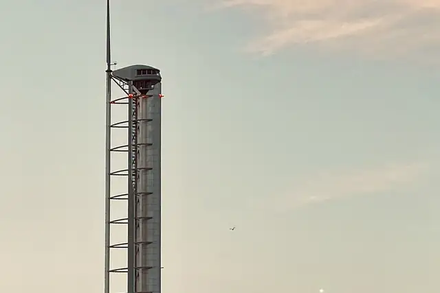
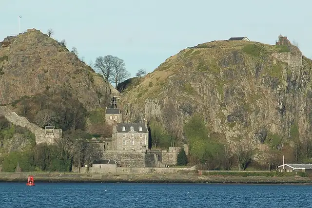
Glasgow's castles start close in: Haggs Castle at 4 km, Cathcart Castle at 5.8 km, Crookston Castle at 7 km, Bedlay Castle at 11.2 km, with Dumbarton Castle on its rock at 20.7 km, 23 in all. The Antonine Wall is 7.2 km from the center, and the Cochno Stone at 11.6 km heads 72 archaeological sites. The Glasgow Tower at 2.5 km is the modern lookout.

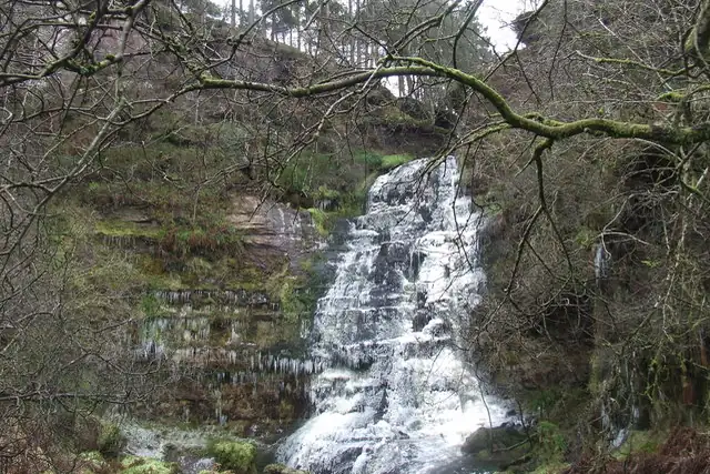
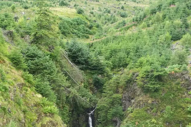
Thirty-one waterfalls is the figure to notice: the Loup of Fintry at 21.5 km, Ishneich at 20.6 km, Calderwood Linn and the Grey Mare's Tail Waterfall at 13 km among them. Meikle Bin at 18.1 km and Duncolm at 16.5 km are the big hills. Waterfalls make good quests: you know when you've arrived.

72 Archaeological sites37 Monuments31 Waterfalls30 Ruins23 Castles and palaces16 Viewpoints4 Beaches and swimming spots3 Caves

Where the places are

Each hexagon covers a little over 5 square kilometers. The brighter it glows, the more places are inside it. The numbers mark the highlights listed below; the dot in the middle is the center of Glasgow.

Few places to many

12345678

Worth the trip around Glasgow

The places with the most to tell about. The numbers match the map.

Places by type

A selection for each type, best known first. The number next to each heading counts everything RLQuest knows within the radius.

Castles and palaces 23

  • Crookston Castle7.0 km
  • Cathcart Castle5.8 km
  • Cadzow Castle (ruin)19 km
  • Bedlay Castle11 km
  • Haggs Castle4.0 km
  • Mearns Castle11 km
  • Balgray Tower3.0 km
  • Orchardhill Tower7.5 km
  • Patterton Tower9.6 km
  • Gilbertfield Castle9.6 km
  • Peel Castle9.7 km
  • Castlehill (Motte & ditches)10 km

and 8 more

Lighthouses 1

  • Blythswood Beacon9.4 km

Viewpoints 16

  • Mackintosh Tower0.6 km
  • Hill Street Viewpoint Garnethill0.8 km
  • The Tur Viewing Platform4.2 km
  • Queen Mary's Seat7.9 km
  • Aidans Brae Viewpoint8.7 km
  • General RC model airfield11 km
  • RC Heli airfield11 km
  • Lovers Leap12 km
  • Formal (Remote) Wilderness Landscape Feature13 km
  • Basket Craig13 km
  • Calderwood Glen viewpoint13 km
  • Dee of Calder13 km

and 4 more

Waterfalls 31

  • Ladies Linn10 km
  • Lady's Linn12 km
  • Crossbasket Linn12 km
  • Basket Falls (petrified)13 km
  • Grey Mare's Tail Waterfall13 km
  • Calderwood Linn13 km
  • Lairdmann's Linn13 km
  • The Small Linn13 km
  • Old Horseshoe Linn13 km
  • Fiddlers Falls (lower)13 km
  • Fiddlers Falls (upper)13 km
  • Black Linn (The Commandos)14 km

and 16 more

Ruins 30

  • Former North Woodside Flint Mills2.1 km
  • Cathcart Old Parish Church Tower5.2 km
  • Mugdock Castle12 km
  • Site of Pate's Mill12 km
  • Craigend Castle13 km
  • Dundyvan Church14 km
  • Site of Newhousemill14 km
  • Saw Mill Subterranean Tunnel (drainage)14 km
  • Old Hagg Mill15 km
  • St Serfs Church21 km

and 19 more

Caves 3

  • Ross Hall Park Grotto7.3 km
  • Craigneith Cranny13 km
  • Crutherland Cave15 km

Megaliths 3

  • Standing Stone12 km
  • Calderwood Cairn12 km
  • Millennium Stone20 km

Watermills 2

  • Baldernock Mill9.1 km
  • Mid Lettrick Mill (Ruins)12 km

Archaeological sites 72

  • Calderwood Castle13 km
  • Site of Roman Fort16 km
  • Cochno Stone12 km
  • Camphill Earthwork3.9 km
  • Gallowflat Tumulus5.5 km
  • Pollok Tumulus5.9 km
  • Kirk Burn Motte8.9 km
  • Castlehill Fort9.3 km
  • Kirkintilloch Roman fort10 km
  • Castleflat11 km
  • Rough Hill Motte11 km
  • Duntocher Roman fort12 km

and 60 more

Monuments 37

  • Nelson's Monument1.9 km
  • Sir Walter Scott column0.6 km
  • Mercat Cross1.3 km
  • Sir William Wallace Memorial1.5 km
  • John Knox Monument1.6 km
  • Nelson Monument1.9 km
  • Battle of Langside Monument4.2 km
  • Empire Exhibition Monument4.5 km
  • Monument Showing Engines of Paddle Steamer Clyde8.2 km
  • Middle Monument9.7 km
  • ORP Piorun Memorial10 km
  • Queen Victoria Monument11 km

and 25 more

Beaches and swimming spots 4

  • Netherlee Stone Beach7.0 km
  • Sandy Bays13 km

and 2 more

Summits 95

  • Neilston Pad15 km
  • Meikle Bin18 km
  • Duncolm16 km
  • Broom Hill1.1 km
  • Sighthill1.9 km
  • Rushy Hill6.6 km
  • Parkhill Head7.5 km
  • Hornshill7.9 km
  • Bargeny Hill8.6 km
  • Kenmuir Hill8.6 km
  • Arronhill8.8 km
  • Woodhead9.1 km

and 83 more

Bunkers 3

  • Pillbox8.8 km
  • Cold War Nuclear Bunker (Scheduled Ancient Monument)14 km

and 1 more

How Glasgow turns into a game

RLQuest knows these places too. Which means:

1

Places become quests

Some of your daily quests lead to a real place near you. The app uses your location to check you were really there.

2

Being first pays off

If you're the first person in RLQuest to complete a quest at a place, it's your first find. The Place Book shows you which kinds of place you're still missing.

3

The map fills in

Every walk uncovers tiles, each about 350 m across. Over time you can see which corners you know well, and where you've never set foot.

App Store Google Play

In the region

Nearby cities

Place data © OpenStreetMap contributors, available under the Open Database License. As of 2026-09-30. The list shows the places RLQuest knows and isn't complete. Photos come from Wikimedia Commons; author and license are credited on each photo.